Wednesday, July 31, 2013
Arches, arches, everywhere
We were in Arches NP all day. We took the longest trail with the most access to the most arches in the park. It was a long day. We weren't alone on the trail. Most of our fellow hikers were what we South Carolinians call "furners". I'd say 90%. We're both sorta worn out so we might do something easier tomorrow.
Tuesday, July 30, 2013
Moab Utah
We had a short drive, (1 hour) to get to Moab. The MP and the car were due oil changes so that was the first thing we did when we arrived. We are staying at a hoity toity RV resort just North of town. To stay here your RV must be less than 5 years old, it must be a class A or a super C. I don't know what that is, either. In preparation for our attempt to check in, Jenny put on make-up and I shaved and put on a collared shirt. Bingo baby, we're in. We have the smallest rig by far. We visited the Arches NP visitor center to plan our hike tomorrow. After that, I did an 18 mile bike ride. Moab is the mountain biking capital of the known universe. I'm hoping to sample some of the trails in the next few days. We will be here for maybe a week. This pic is Park Service humor.
Green River Utah
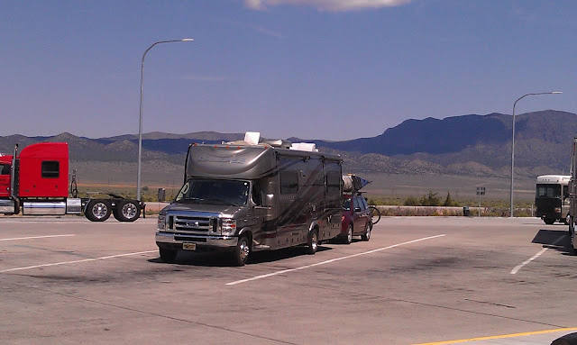
We're headed for Moab. The drive from Great Basin was a little longer than I care to do in one stretch so we stopped at Green River St. Park. We've tent camped here before so we kinda knew it. There are some lonely roads in this part of the country. I took this pic while driving on Hwy 50, west of Delta Ut.
Monday, July 29, 2013
Bristlecone grove hike
You have to drive to the end
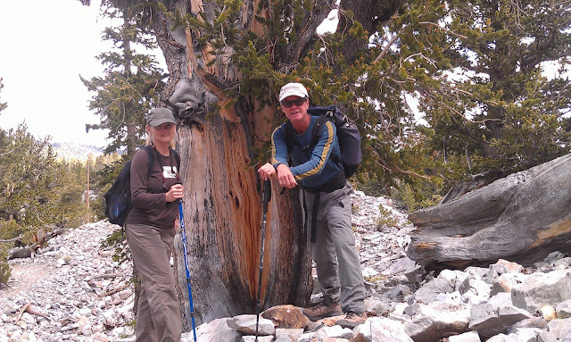
Of the road up an 8% grade for 12 miles to get to the trailhead at 10500 feet for the Bristlecone trail. We were out of breath walking to the outhouse. The grove we hiked to was in a very rocky area just below the tree line. There were as many dead ones as live ones. The wood is so dense that a dead tree can remain standing for 2500 years. I'm not making this up. Tomorrow we begin our course reversal--eastward Ho.
Great Basin National Park Nevada
We are here because I want to visit one of the Bristlecone pine groves in the park. They grow between 9000 & 11000 feet and are the oldest living things on earth. They cut one down in the 60s and it had 4900 growth rings. We are camped at 7000 and we did a pretty vigorous hike yesterday above 8000. We will probably only stay 2 nights.
Friday, July 26, 2013
Zion backpack day 3
Zion backpack day 2
We are base camping (not moving camp) so all I had to do this morning was fix breakfast. Spam & grits. It's kinda like shrimp & grits only with Spam. I did my hike today. I was gone for nearly 6 hours and didn't get to the lake I was trying to find. The GPS had me .47 miles away but I had already been out 2 1/2 hours and that last bit was going to be a bushwacking extravaganza. Oh well. It was one of those "it's better to have tried and failed" things. Don't know yet if the creek will 'flash' again. There are some thunderstorms around but they are far off. Tomorrow we backtrack the 8 miles back to our car. We'll stay 2 more nights in Virgin. We need to come up with a plan for the next few weeks. We've been out over 2 months.
Zion backpack day 1
It's 8PM, I'm laying on my sleeping bag listening to the thunder echo off the canyon walls. We had rain earlier and the creek flash flooded. A flash flood is really an amazing thing to witness. You hear it before you see it. The clear, tranquil creek becomes a raging torrent, pushing debris in front of a wall of water the color of chocolate milk. We are in the monsoon here so thunderstormy afternoons are normal. The hike in, covered 8 miles and took nearly 5 hours. I've got a small lake I'd like to find tomorrow. It's a difficult bushwack that might be impossible so Jenny isn't going. I'll give it a try and see how it goes.
Monday, July 22, 2013
In the saddle
We drove to the visitors center early in order to get our back country permit for our backpack tomorrow. We then rode our bikes to the lodge and ate breakfast. After that we continued up the canyon until the road dead ends. We then returned to the car. The whole deal took 4 hours. One of the following pics shows Jenny looking up at where we were yesterday. There will be no posts for at least 3 days. We are backpacking in La Verkin creek. Camped at site 12.
Sunday, July 21, 2013
Pretty hairy hike.
We got going pretty early so we could nab a parking spot at the visitor's center. We still had to ride the park shuttle a couple of stops to get to the trail head. It's only 2 1/2 miles to the top but its 1500 feet of elevation gain, so It's real steep. The last 1/2 mile is a scrambling climb. The park service has provided chain guardrails in places but there were many scary unprotected sections. The round trip took us 4 hours. The views from the top of Angels Landing were really indescribable. A camera can't really capture the scenery. Here are a few pics anyway. Tomorrow I think we'll bike ride.
In Virgin
The town was named for The Virgin River, that flows through it. I've got no idea how the river got its name. We drove over 2 mountain passes today, both around 8000 feet. The MP struggled some. At one point I was going 35 mph under the speed limit. We have become what used to be a source of dread (the RV up ahead towing a car driven by some old guy) At least we were moving. Tomorrow we do a hike I've always wanted to do in Zion named Angels Landing. I want to do a backpack in a few days. We went to the back country desk and the ranger told us we would have to come in early on Monday to try & get a permit. Say what? This pic was taken behind the RV park in Virgin. The river is the towns namesake.
Saturday, July 20, 2013
Friday, July 19, 2013
Last day at Capital Reef
We hit the trail again this morning. The Chimney Rock Trail. I wonder how many Chimney Rocks there are in this country? Seems like they're everywhere. We walked through a sedimentary layer that had a lot of petrified wood in it. Petrified wood can be caused by taking 2 viagaras instead of 1. There are other causes but that's the most common. We head toward Zion, tomorrow.
Thursday, July 18, 2013
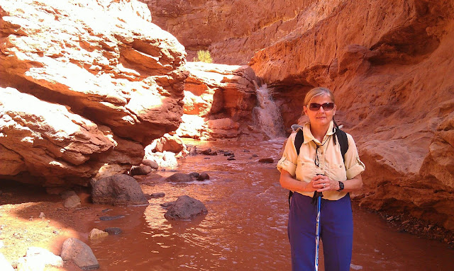
Sulphur Creek
Wednesday, July 17, 2013
Moved to NP campground
Tuesday, July 16, 2013
NP exploritorium
Confidence is the feeling you get before you fully realize the situation
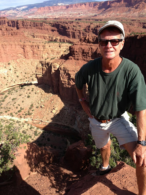
I saw that on a T-shirt and thought it applied to me. We drove around the park today. That's Capital Reef National Park. The park protects the Water Pocket Fold. It's a fault in the earths crust that has pushed up a 100 mile long ridge, exposing hundreds of millions of years of sedimentary rock. The capital reef name, comes from an exposed rock that sorta looks like the capital dome. You can see it in one of the pictures in this post. Tomorrow we will move into the park campground. They have no cell phone and no WiFi. We will probably drive into Torrey every afternoon to check messages.
Monday, July 15, 2013
Torrey Utah
Sunday, July 14, 2013
Headed for Torrey Ut.
Should have little or no WiFi in Torrey. It's a small town near Capital Reef NP. We will try to stay in touch. Jenny always seems to find a way.
Saturday, July 13, 2013
H2O-NO
Wednesday, July 10, 2013
Half a tank
Tuesday, July 9, 2013
Bluff Utah
I have been here many times. Jenny and I have been here alot. We are in the heart of the 4 corners. The San Juan river flows through town. The Morman prophet, Brigham Young, wanted to spread Mormonism south of Salt Lake and he is responsible for the settlement of Bluff. The story of the pioneers journey here is epic. We are in a commercial campground.
Monday, July 8, 2013
Last day at Bandelier
I did a little off trail exploring this morning and came upon a unexcavated ruin on the mesa top. There were quite a few relics laying around. Here are a couple of pottery shards I found. I left them where I found them. We should be in Bluff Utah tomorrow. It will be a base for one of our backpacking trips.
Sunday, July 7, 2013
It wasn't too boring
Saturday, July 6, 2013
Bandelier NM
We are up around 6000 feet. The wind is blowing through the Ponderosa pines and there is a thunderstorm around here somewhere. Pretty neat. We got in reasonably early, visited the visitors center and then did a loop hike to see a few of the pueblo ruins. The campground is mostly for tents but there are a few sites that were suitable for the MP. We had a fairly informative discussion with a volunteer ranger and have decided on a few hikes. We're here for at least 3 days. We might stay longer. Jenny considers 'roughing it' to be, no internet. Her standards have changed apparently.
Friday, July 5, 2013
Tak'n care of business
We needed a day in civilization to do a few things. I got a haircut, we ate Mexican food, went shopping at 'Camping World', Bought groceries and did laundry. We also needed a destination for tomorrow. We decided on Banderlier National Monument. It's northwest of Santa Fe near Los Alamos. I've known about it for many years but have never been there. There are Indian ruins and good hiking. There are no hookups so we will have to be self contained. I filled up the fresh water and will drain the dirty water tomorrow. Cell coverage is non-existent apparently so this might be it for awhile. I'll send a spot if I think about it.
Thursday, July 4, 2013
Out of Texas
It took us 33 days but we are now out of Texas. We stayed in 7 different state parks. We are trying to figure out where to go next. Don't know yet. Here are a couple of pics taken during a backstage tour of the outdoor musical "Texas" that we did yesterday.
Wednesday, July 3, 2013
Trail Ride
Palo Duro is supposed to have the best mountain biking in Texas. I can't argue that. I have had many good bike rides on this trip but todays was really fine. I was only scared S%&#less a couple of times and I broke no bones. The outdoor musical we saw last night was very well done. Quite a production. Tomorrow we move to Albuquerque.
Tuesday, July 2, 2013
Light House
Monday, July 1, 2013
Palo Duro Canyon
We drove through a bunch of Texas towns that I have never heard of. My favorite was, Turkey Texas. The canyon sort of sneaks up on you. I guess that's what canyons do. The weather cooled off quite a bit. I guess we won't be frying eggs on the aluminium picnic table. Absolutely no cell service in the canyon. We had to drive up to the top and use our 'Wilson Sleek signal booster'. It still might not work. If this goes out I suppose it did.


